
New suburb map previews: see what is nearby
A suburb map with photos puts local places beside estimated journeys, helping you decide what to visit around a home.
 By Luke Metcalfe · Founder, Microburbs
You can see it in the examples below. Planned for property and suburb reports. These maps are previews, with photo selection still being checked.
Castlecrag map: how does the starting point change the journey?
Compare the same landmark from a home and the suburb centre in Castlecrag, Sydney NSW. Journeys are estimates, not checked on foot.
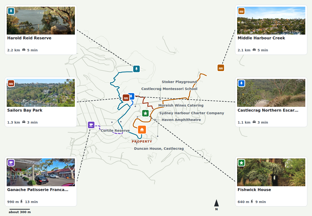
98 The Bulwark, Castlecrag, Sydney NSW Prepared 9 September 2026 · Photo dates not established
Why this one: The same destination appears in both maps, so the starting point can be compared.
What you see Fishwick House is shown 640 m away, with an estimated nine-minute walk from this home. What it means Use the home as the starting point when deciding what is close enough for you.
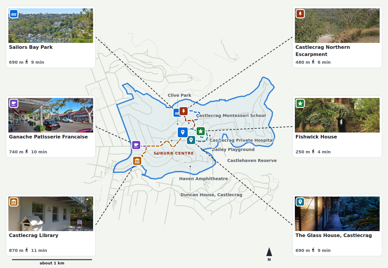
Castlecrag, Sydney NSW: suburb overview Prepared 9 September 2026 · Photo dates not established
Why this one: The matching suburb view shows how a general guide differs from one home.
What you see Fishwick House is shown 250 m away, with an estimated four-minute walk from the suburb centre. What it means A suburb-wide journey estimate does not describe every home in the suburb.
Start with the home for a property decision. Use the suburb view to get your bearings before you inspect.
Coogee map: what is nearby?
This Coogee, Sydney NSW preview brings the park, oval and coastal places onto one map. The blue outline shows the suburb boundary. Journeys start at the suburb centre, not at a home.
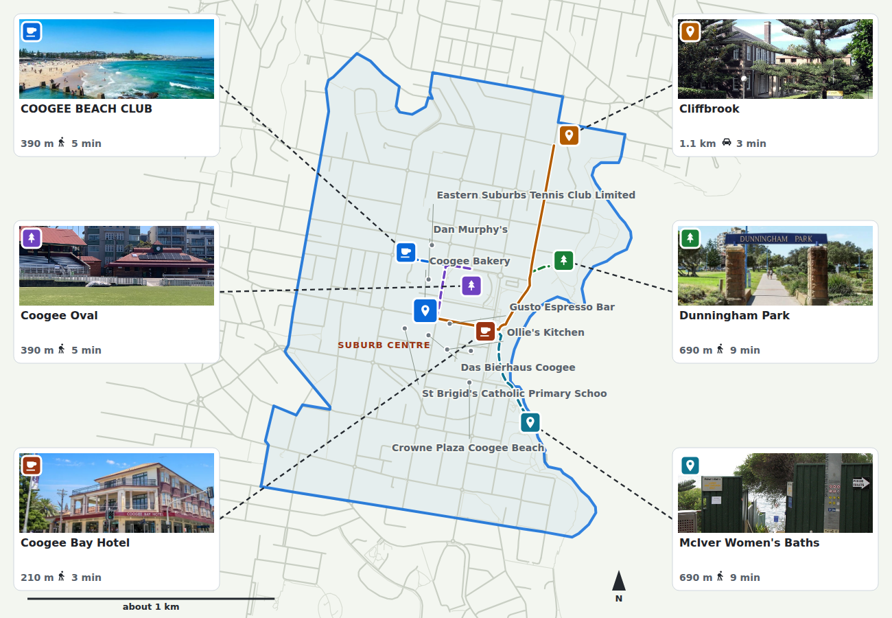
Coogee, Sydney NSW: coast, park and oval Prepared 9 September 2026 · Photo dates not established
Why this one: A coastal example broadens the preview beyond Castlecrag. The beach panorama labelled Coogee Beach Club still needs checking against the named place.
What you see Coogee Oval is shown 390 m away and Dunningham Park 690 m away from the suburb centre. What it means Use the overview to choose places to visit, then check the journey from your shortlisted home.
Suburb profile: what do the photos add?
Use the overview to choose inspection stops, then check which shortlisted home puts those stops within a journey you would accept.
This preview does not establish travel-time accuracy. Distances and journey times are estimates and have not been checked on foot. Photo dates are not established.
Check the route from your home, current access and the place itself before relying on the preview. It is a starting point for an inspection.
Compare the two starting points
Where can I use the new maps?
You can view these examples here. Adding the maps to customer property and suburb reports is planned. Availability across Australia is not established by these Sydney examples.
Compare the two starting points
Explore the home and suburb examples before choosing what to inspect.
View the Castlecrag maps