
That's right. We went through the credit card transactions from the Ashley Madison dump to find unique users and used this to identify the most adulterous places in the country - or at least the most curious about Ashley Madison.
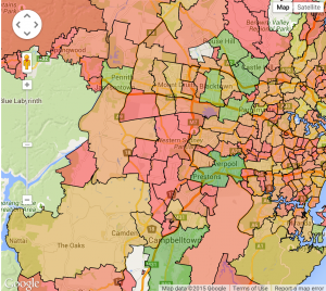
See it on our new heatmap tool
Showing postcodes with at least 1000 residents. We sort by % of adult population on Ashley Madison.
The top 20 in NSW and ACT:
Top 20 in Victoria:
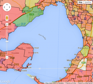
See our interactive map for Melbourne.
| Rank | PostCode | # Ashley Madison accounts | Adult residents | % of adult population |
|---|---|---|---|---|
| 1 | MELBOURNE 3000 | 639 | 28253 | 2.26% |
| 2 | SOUTH MELBOURNE, SOUTH MELBOURNE DC 3205 | 51 | 8246 | 0.61% |
| 3 | BAREENA, GEELONG, NEWTOWN 3220 | 68 | 13265 | 0.51% |
| 4 | MELBOURNE, ST KILDA ROAD CENTRAL 3004 | 43 | 8740 | 0.49% |
| 5 | WONGA PARK 3115 | 13 | 2971 | 0.43% |
| 6 | DOCKLANDS 3008 | 23 | 5279 | 0.43% |
| 7 | WILLIAMS LANDING, WILLIAMS RAAF 3027 | 11 | 2549 | 0.43% |
| 8 | CARRUM, PATTERSON LAKES 3197 | 37 | 9015 | 0.41% |
| 9 | PLUMPTON, ROCKBANK 3335 | 6 | 1480 | 0.40% |
| 10 | COLLINGWOOD, COLLINGWOOD NORTH 3066 | 22 | 5539 | 0.39% |
| 11 | TYABB 3913 | 10 | 2561 | 0.39% |
| 12 | ST KILDA, ST KILDA SOUTH, ST KILDA WEST 3182 | 75 | 19400 | 0.38% |
| 13 | GARDEN CITY, PORT MELBOURNE 3207 | 47 | 12419 | 0.37% |
| 14 | CAMPBELLFIELD 3061 | 16 | 4259 | 0.37% |
| 15 | BURNLEY, BURNLEY NORTH, CREMORNE 3121 | 88 | 23563 | 0.37% |
| 16 | WEST MELBOURNE 3003 | 13 | 3573 | 0.36% |
| 17 | NEERIM, NEERIM EAST, NEERIM SOUTH 3831 | 4 | 1120 | 0.35% |
| 18 | HAWKSBURN, TOORAK 3142 | 39 | 11205 | 0.34% |
| 19 | BRIGHTON ROAD, ELWOOD 3184 | 43 | 12388 | 0.34% |
| 20 | SOUTH WHARF, SOUTHBANK 3006 | 47 | 13588 | 0.34% |
Top 20 in Queensland:
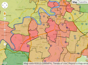
See our interactive map for Brisbane
Top 20 in South Australia:
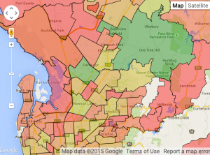
See our interactive map for Adelaide
Top 20 in Western Australia:
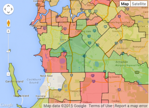
Interactive map for Western Australia
| Rank | PostCode | # Ashley Madison accounts | Adult residents | % of adult population |
|---|---|---|---|---|
| 1 | CITY DELIVERY CENTRE, PERTH, PERTH GPO 6000 | 275 | 11900 | 2.31% |
| 2 | KINGS PARK, WEST PERTH 6005 | 26 | 5245 | 0.49% |
| 3 | JURIEN BAY 6516 | 5 | 1169 | 0.42% |
| 4 | HERDSMAN, OSBORNE PARK, OSBORNE PARK DC 6017 | 15 | 3527 | 0.42% |
| 5 | TWO ROCKS 6037 | 7 | 1659 | 0.42% |
| 6 | MUNDARING, MUNDARING DC 6073 | 10 | 2424 | 0.41% |
| 7 | BUTLER, JINDALEE 6036 | 27 | 7291 | 0.37% |
| 8 | FREMANTLE 6160 | 27 | 7491 | 0.36% |
| 9 | SECRET HARBOUR 6173 | 24 | 6972 | 0.34% |
| 10 | SCARBOROUGH, WEMBLEY DOWNS 6019 | 54 | 17175 | 0.31% |
| 11 | RIVERVALE 6103 | 22 | 7268 | 0.30% |
| 12 | LEDA, WELLARD 6170 | 14 | 4763 | 0.29% |
| 13 | HIGHGATE, NORTHBRIDGE 6003 | 8 | 2744 | 0.29% |
| 14 | YANCHEP 6035 | 9 | 3127 | 0.28% |
| 15 | BANKSIA GROVE, CARRAMAR, NEERABUP 6031 | 21 | 7927 | 0.26% |
| 16 | AVELEY, BELHUS, BRIGADOON 6069 | 47 | 17852 | 0.26% |
| 17 | BAUDIN, COWARAMUP, GRACETOWN 6284 | 3 | 1142 | 0.26% |
| 18 | BURSWOOD, LATHLAIN, VICTORIA PARK 6100 | 32 | 12305 | 0.26% |
| 19 | BURNS BEACH, CURRAMBINE, ILUKA 6028 | 39 | 15096 | 0.25% |
| 20 | CARLISLE, CARLISLE NORTH, CARLISLE SOUTH 6101 | 32 | 12448 | 0.25% |
Browse the data yourself on an interactive map using our new heatmap tool.